|
SUNDAY,
August 26th 2007
MOUNT
MANSFIELD, Vermont, USA
my
order #1/21
Canyon
North Trail & Subway
Halfway House Trail, Canyon
North Trail then up to Long Trail to Chin, Long Trail
back to Subway Loop and Sunset Ridge Down
With Gabriel
HIKING start 9h09 AM
WEIGHT OF PACSAC : 17,8 lbs
DENIVELATION 762 m. + Down and up for Subway ??
+ up and down for Cantilever Rock ??
MAJOR DIFFICULTY Canyon North Trail and Subway
: WOW !!
TOTAL LENGTH 12,6
km 7,85 miles
TOTAL TIME
7 h 30
TEMPERATURE : High 50s°F / 100%
Humidity!!!
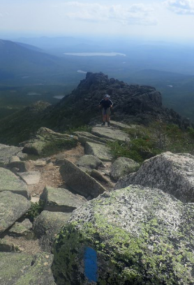
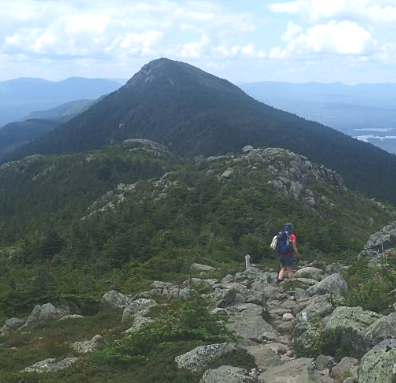
Blue
markers lead the way up and down.. the Long Trail on
top had white markers. Everything very clear.
UP Eagle
Trail, CCC Road, Halfway House Trail, and almost
completely ACROSS : Canyon North Trail,
2h30 mins / 1565 calories / 35% fat /
AveHR 133
80% /
MaxHR 159
95% /
1h45 mins inZone (75%+)
LUNCH
Just a little
before the Short-cut up to
Long Trail
11 mins
Last Short-Cut to Long Trail to
CHIN
1h29 mins / 861 calories / 40% fat / AveHR
127
76% /
MaxHR 157
94% /
47 mins inZone (75%+)
The
Canyon North Trail had taken everything out of me..
not physically, but emotionally. and we didn't know if
the Subway would be even more difficult. Gabriel was
also very willing not to do the Subway section at this
time.
DOWN
: Long Trail, Short-cut, Subway ,
( Counter clock-wise
loop )
52 mins / 501 calories / 45% fat / AveHR
126
75% /
MaxHR 155
93% /
26 mins inZone (75%+)
Gabriel's suggestion to do
the part we didn't do this morning, now that we knew
where it ended and had done the rest of the climb. I
asked someone who seemed to know the area if the
Subway was more difficult than the Canyon North Trail
and she said "No, except there's a little more in the
"open". I later understood that to mean you fall real
far if you slip.... so extreme caution is necessary.
Long Trail to
Sunset Ridge Trail to Cantilever Rock, and short lunch
1H19 mins / 648 calories / 50% fat / AveHR
116
69% /
MaxHR 146
87% /
11 mins inZone (75%+)
Cantilever Rock, Sunset Ridge
Trail to Eagle Trail to Parking
59
mins / 406 calories / 60% fat / AveHR 105
63% /
MaxHR 129
77% / 2
mins inZone (75%+)
NOTES :
1) The Canyon North Trail and Subway would have been
extremely dangerous if they had been wet.
2) It's better to go UP Halfway House trail than down.
3) This is definately NOT a trail for the un-experienced
4) Round fasteners on Gaiters hurt too much and are
dangerous in situations where you have to use your
Knees to climb.
5) If because only a small hike is planned, you
workout real hard at the gym the days before the hike,
beware if you change you plans to a difficult hike
6) Wear my contact lenses...
|
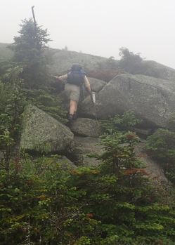
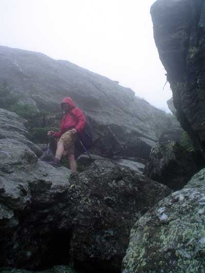
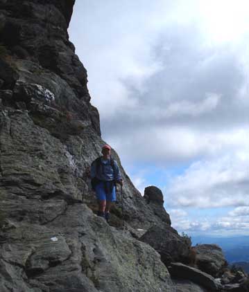
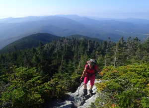
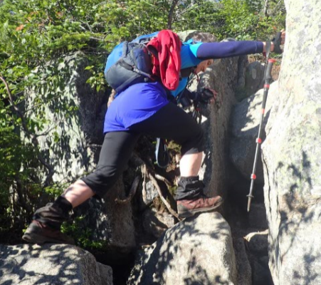
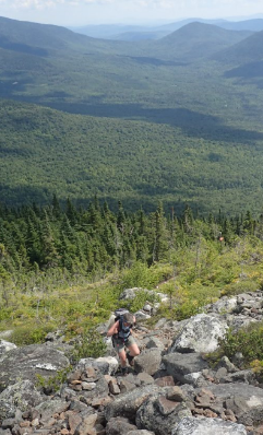
Gabriel on the Canyon North Trail and then in
Short-cut between Canyon North Trail and Long
Trail. |
 |
|
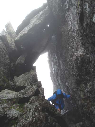
Of
course we couldn't take pictures when we were in
difficult situations. / Later I find out this is
called Scrambling.. (not hiking) |
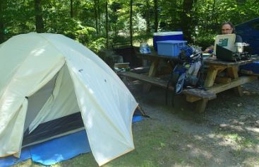
 |
DIET.
Excellent and very well deserved Restaurant in
Cowansville
BED AT 1h30 PM |
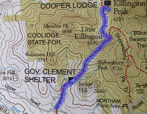
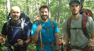 Three
guys doing the Long Trail South to north.
They plan on doing it in 3 weeks and seemed
quite curious about their first 4000-footer..
Killington, just ahead. I was sorry to say
that the view from the top didn't impress me
that much, but alot of people found it
beautiful. I said it depends on what else
you've seen in your life.
Three
guys doing the Long Trail South to north.
They plan on doing it in 3 weeks and seemed
quite curious about their first 4000-footer..
Killington, just ahead. I was sorry to say
that the view from the top didn't impress me
that much, but alot of people found it
beautiful. I said it depends on what else
you've seen in your life.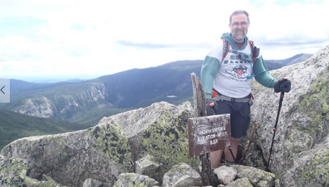
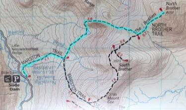

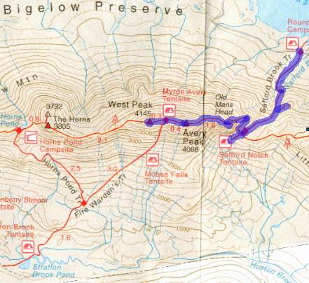
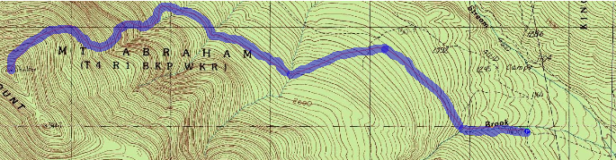
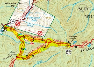
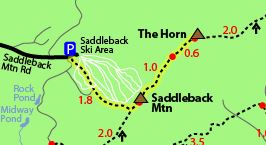
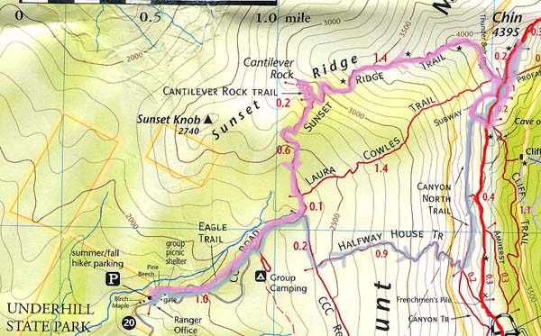
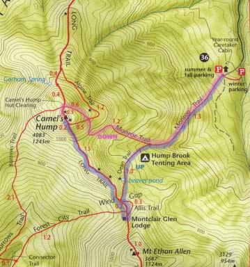
 MAP
: We chose a short but steep route.. with blue (B) trail
markers all the way up and then
MAP
: We chose a short but steep route.. with blue (B) trail
markers all the way up and then