|
SATURDAY,
August 12th 2006
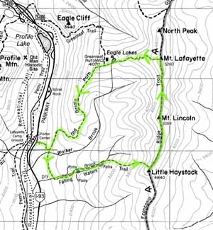
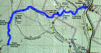
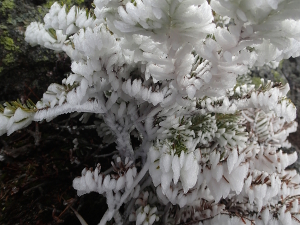
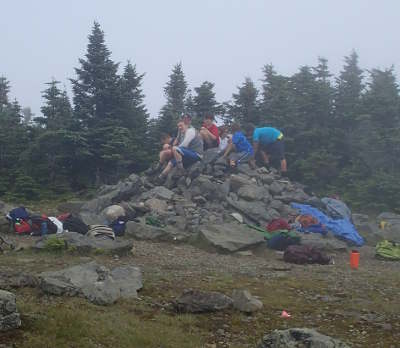
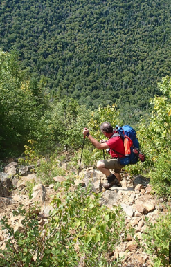
FRANCONIA NOTCH STATE PARK, New Hampshire, USA Rambling : hummmm 1,173 m, that's 3,848 ft.. talking about denivalation.. that's sort of like going up AND THEN down 7,696 six-inch steps..
DIET. |
NH 48 Logs ALL
Gabriel & Mary-Lou
LIST OF ALL THE DATES HERE
|
SATURDAY,
August 12th 2006
FRANCONIA NOTCH STATE PARK, New Hampshire, USA Rambling : hummmm 1,173 m, that's 3,848 ft.. talking about denivalation.. that's sort of like going up AND THEN down 7,696 six-inch steps..
DIET. |
|
SATURDAY, September
2nd
2006
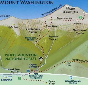
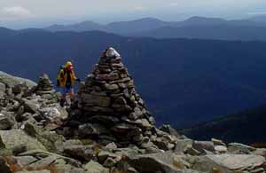
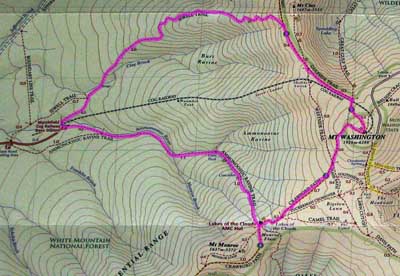
MOUNT WASHINGTON,
New Hampshire, USA
|
|
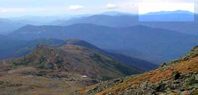
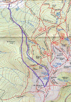
SUNDAY, September 23rd 2007
MOUNT JEFFERSON,
New Hampshire, USA
NOTES :
|
|
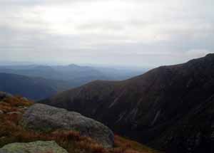
SUNDAY, August 16th 2009
FRANCONIA NOTCH STATE PARK,
New Hampshire, USA
HIKING start 8h02 AM
BED AT 11h00 PM |
|
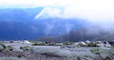
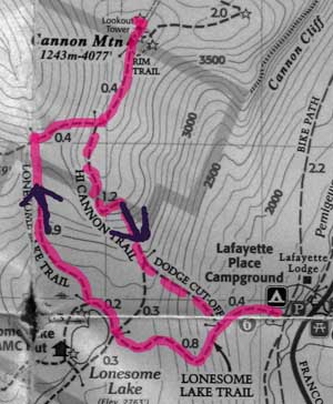
FRIDAY,
July 1st 2011
CANON MOUNTAIN, New Hampshire, USA
|
|
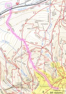
MOUNT ADAMS,
New Hampshire, USA
Campfire with Yves Richard and Cindy's friends' camp
sites #1&2. Yves and his friend did Mount Washington up
Amooos... and down Jewell |
||||||||
|
SATURDAY, June
30th 2012
UP
Ammonoosuc to Monroe, down to Lakes of the Clouds and
up Washington :
BED
AT 7h00 PM
! |
||||||
|
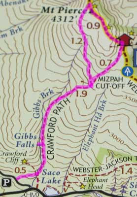
SUNDAY, July 1st 2012
Pierce (Clinton)
UP
2h42 mins / AveHR 120
72%
/ MaxHR 143
86%
/ 1048 cals / 45 % fat / 1h07 mins InZone
CAR TRIP HOME BED AT 11h00 PM |
|
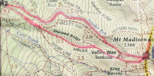
MOUNT MADISON,
New Hampshire, USA
HIKING
start 6 h 30 AM
|
|
SATURDAY,
July 12th 2014
BED AT 9h30 PM at Country Squire Motel, Littleton. Room #3 |
||||||
NOTE : On July 25th 2014 we finish the
ADK 46 and decide to
go on and do the White Mountains 48.
In 2006 when Gaby said he'd like to do the ADK 46, I said
I'd rather to the 10 highest in the Whites..
I guess we'll get to do those :)
|
SATURDAY,
August 16th 2014
2h30 PM car trip 3 hours 30 mins + 20 mins at customs
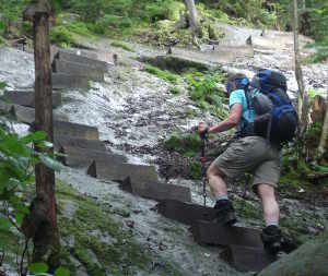
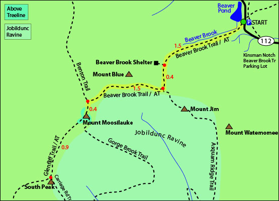
MOUNT MOOSILAUKE
finishing the 10 highest of the Whites that I
wanted to do
UP including walkabout at Beaver Brook Shelter and
lots of Pictures.
TRIP HOME BED AT 9h30 PM |
||||||
|
SUNDAY,
October 12th
2014
4h30 AM car trip 3 hours 30 mins + (including 4 mins
at customs)
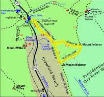
MOUNT JACKSON and Webster loop
Aches & Pains : really feel my last two days of trainging.. quite glad that it was a moderate hike today. just perfect.
TRIP HOME BED AT 10h00 PM M+2 arrive later |
|
SATURDAY,
July 3rd 2015
5h200
AM car trip 3 hours (including 10 mins at customs)
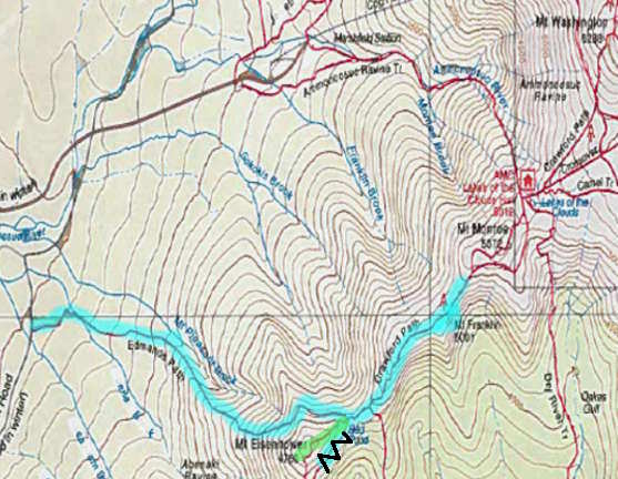
MOUNT
EISENHOWER and FRANKLIIN extra TEMPERATURE 15°C and sunny, Aches & Pains : This is a test run and it's all good, but I'm very nervous about my right knee and wrist.
TRIP HOME BED AT 9 h00 PM |
|
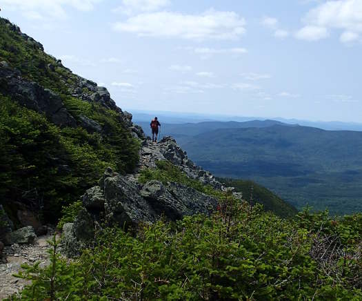
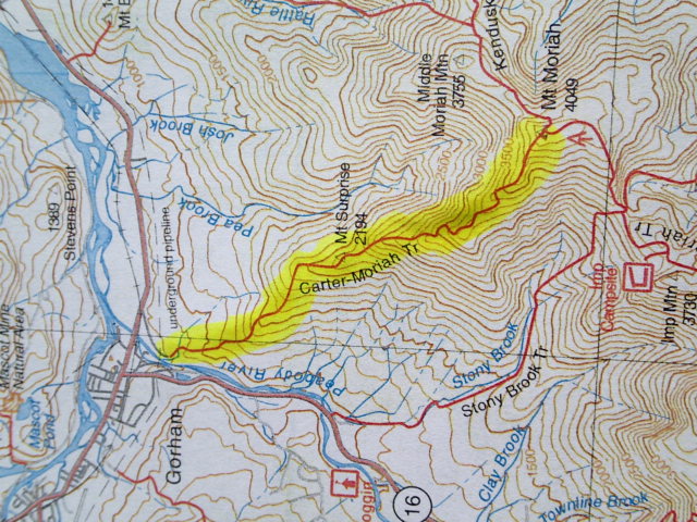
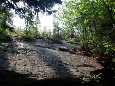
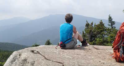
MONDAY,
July 13th 2015
5h200 AM
car trip 3 hours (including 5 mins at customs)
Mount
Moriah, NEW HAMPSHIRE TEMPERATURE Warm. Heard thunder for about 45 mins, but only had a few drops of rain near the end of the hike. Just in time before the showers. Aches & Pains : Th
BED AT 9 h00 PM at :Northern Peaks Motor Inn, Gorham. Room 18; with microwave oven and small fridge. |
|
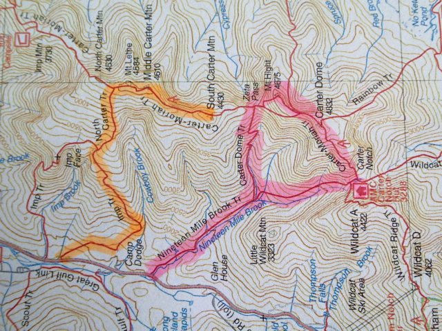
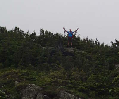
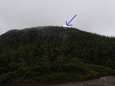
TUESDAY, July 14th 2015
Mount
Middle Carter and Mount South Carter, NEW HAMPSHIRE TEMPERATURE Quite a few times during the day we thought it would rain, so we put the pac covers on but it was very warm.
BED AT 8h00 PM at : Northern Peaks Motor Inn, Gorham. Room 18; with microwave oven and small fridge. |
|
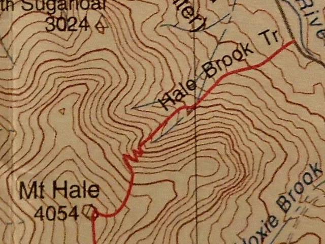
WEDNESDAY, July 15th 2015
Mount
Hale, NEW HAMPSHIRE TEMPERATURE Rain starting at 3 AM until about 10 AM. so we changed our plans to do a hike mostly in the afternoon. Aches & Pains : Th
BED AT 9h30 PM at : Northern Peaks Motor Inn, Gorham. Room 18; with microwave oven and small fridge. |
|
THURSDAY,
July 16th 2015 TEMPERATURE Beautiful, Sunny and cool! Aches & Pains : Th
TRIP HOME BED AT 9 h00 PM |
|
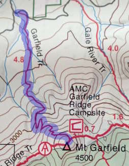
TUESDAY,
July 21st 2015
4h20 AM
car trip 3,5 hours (including 5 mins customs )
Mount
Garfield, NEW HAMPSHIRE TEMPERATURE Hot and humid but nice on top.
BED AT 9 h00 PM at :Northern Peaks Motor Inn, Gorham. Room 16; with microwave oven and small fridge. |
||||||||
|
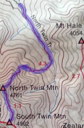
WEDNESDAY, July 22nd 2015
North Twin,
South Twin, NEW HAMPSHIRE = 24!! TEMPERATURE : Perfect! (says Gaby :) Aches & Pains : Th
BED AT 9h30 PM at : Northern Peaks Motor Inn, Gorham. Room 16; with microwave oven and small fridge. |
|
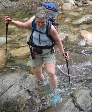
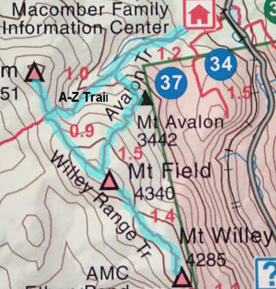
THURSDAY, July 23rd 2015
Mounts
Tom, Field and Willey, NEW HAMPSHIRE TEMPERATURE More clouds than we expected but cleared around noon Aches & Pains : Th
TRIP HOME BED AT 10h30 PM |
|
MONDAY, August 10th 2015 TRAVEL
TO
4h20 AM
car trip 3,5 hours (including 5 mins customs )
North Conway, NH today : First Light : 5:11 / Sunrise 5:43 / Sunset 7:56 / Last Light 8:28
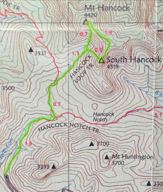
Mount
Hancock & South Hancock, NEW HAMPSHIRE TEMPERATURE Aches & Pains : Th
planned BED AT 9 h00 PM at : White Mountain Hostel, 36 Washington Street, Conway, NH |
|
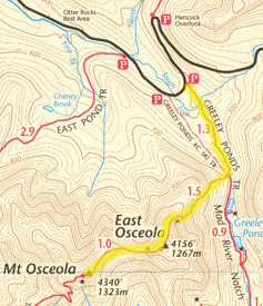
WEDNESDAY, August 12th 2015
Mount
Osceola, East Osceola, NEW HAMPSHIRE TEMPERATURE Aches & Pains : Th
planned BED AT 9 h00 PM at :White Mountain Hostel, 36 Washington Street, Conway, NH |
|
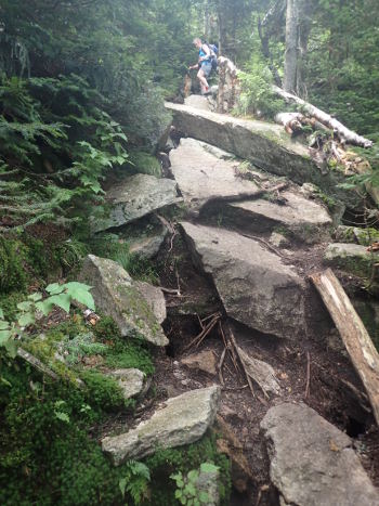
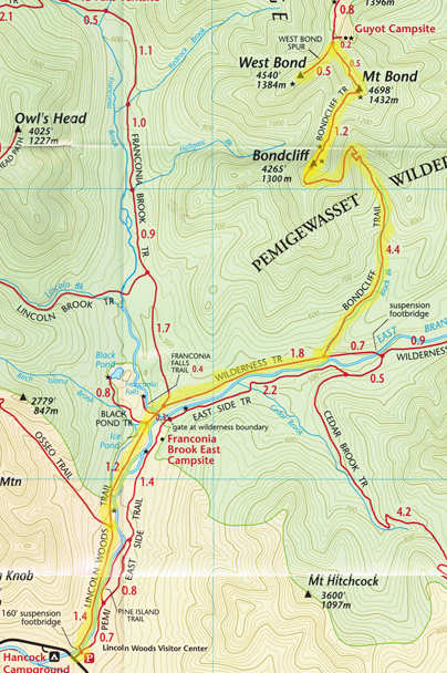
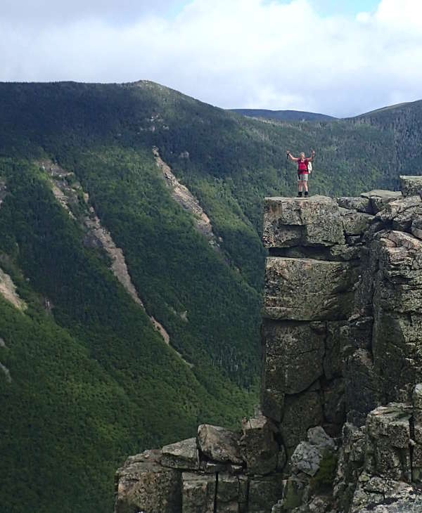
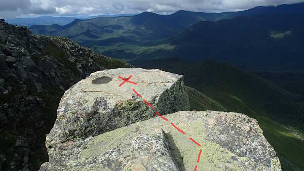
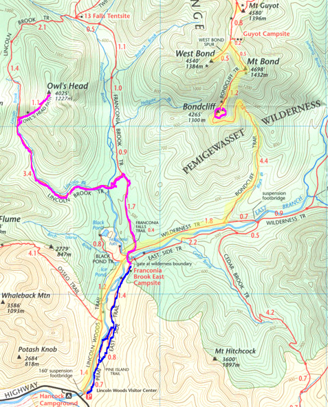
THURSDAY, August 13th 2015:
Mounts
Bondcliff, Bond & West Bond , NEW HAMPSHIRE TEMPERATURE Aches & Pains : Th
planned BED AT 9 h00 PM at :White Mountain Hostel, 36 Washington Street, Conway, NH |
||||||||||
|
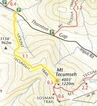
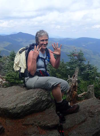
FRIDAY, August 14th 2015
Mount
Tecumseh, NEW HAMPSHIRE TEMPERATURE 21° C at start, and luckily it goes down at least a litte.. t0 18°C Aches & Pains : Th
Trip Home |
|
FRIDAY,
May 20th 2016
Car trip to the Northern-most 4000 footer in the Whites : See a deer in the morning and a moose coming hone.
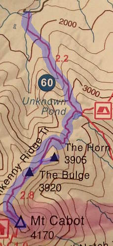
Mount Cabot, White Mountains,
From
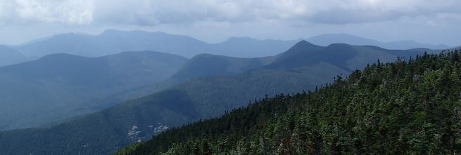
Mill Brook Road Tear a little the skin on my left knee, climbing to the top bolders of the Horn. Gaby says that I don't seem quite as sure of myself as usually, and it's true.. my legs are almost shaking at times from being tired. But the 360° view on a sunny day with snow still on Mount Washington, and a good view of The Buldge and Mount Cabot is worth it. It's the best place to have lunch. Aches & Pains : Just weak and tired.. I think my training this year isn't as effective as it was with A.M. Gabriel takes one of my hydration packs, and I feel better but still it's difficult.
|
||||||
|
SATURDAY,
July
2nd 2016
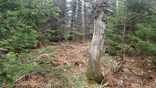
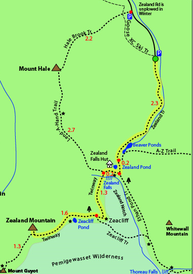
Mount Zealand, White Mountains, From Zealand Road parking. 3$
BED AT 10h30 PM |
||||||
|
SATURDAY,
July 9th 2016
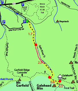
Mount Galehead, White Mountains,
BED AT 10h30 PM |
||||||||
|
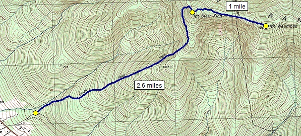
TUESDAY, July
26th 2016 Day 1 CAR TRIP to the WHITE MOUNTAINS, NH. Gabriel's car : TROUBLE!
Mount Wambek
In the evening at the Hostel talk alot with Bob & Leon, not regular hikers but are going to do Mount Washington tomorrow, Billy from Maine, who hikes alot, Xenia from Moscow and Doug and Mark BED AT 10h30 PM at : White Mountain Hostel, 36 Washington Street, Conway, NH room #6 new bed but not much more. |
||||
|
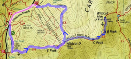
WEDNESDAY, July
27th 2016 Day 2
Wildcat, D& E, and Wildcat A
BED AT 11h30 PM at : White Mountain Hostel, 36 Washington Street, Conway, NH |
||||||||
SATURDAY,
September 3rd 2016
Owl's Head Mountain, NE 98/115
BED AT 8h00 PM Camping Franconia Brook East Tentsite #16 ALOT of hikers at campground arriving at all hours of the evening. SUNDAY, September 4th 2016 DO Bondcliff (again) In the longrun I want do have a separate date for each of the 48 White Mountain High Peaks, so since we did the 3 Bonds at once, we did just Bondcliff this time and plan to go back and do one of the other via Guyot.. some day.. but today doesn't count for the 48 since we've already done all three Bonds.
MONDAY,
September 5th 2016
BACKPACK OUT
CAR TRIP home planned BED AT 10h30 PM AT HOME |
|
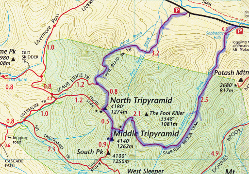
FRIDAY, October 7th 2016
CAR TRIP to Pine
Bend Brook Parking.
North and Middle Tripyramids, NE99 and 100 / 115
CAR TRIP home BED AT 10h00 PM |
||||||||
|
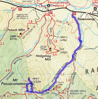
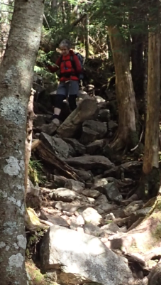
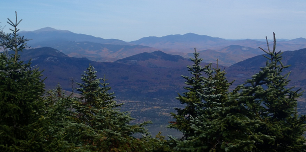
SATURDAY,
October 15th 2016
CAR TRIP to the
Whites
Mount Passaconaway NE 101 / 115
CAR TRIP home BED AT 10h00 PM |
||||||||
|
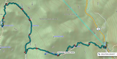
SATURDAY,
September
2nd 2017
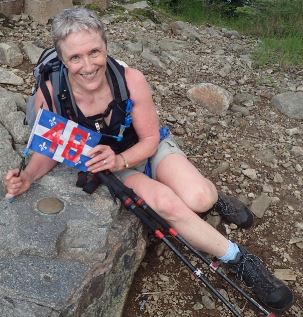
ISOLATION, White Mountains, NH
:NE111
: 102/115 Back-pack 19lbs : so nice that it was less than the 33 lbs I carried around in the Dolomites!
BED AT 10h30 PM at : White Mountain Hostel, 36 Washington Street, Conway, NH |
||||||||
|
SATURDAY,
June
30th
2018
20mins drive to Trail Head.
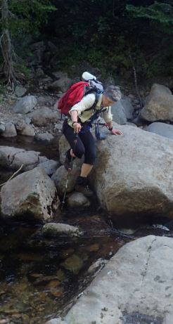
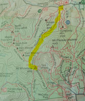
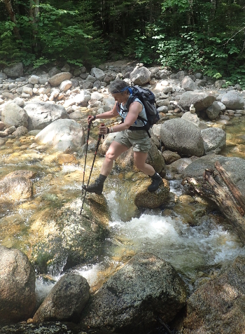
WHITEFACE, NH.
WHITE MOUNTAINS , NE103 / 115
CAR TRIP home BED AT 10h00 PM |
| SUNDAY,
August
5th
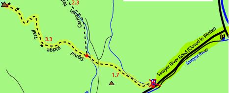
2018 30 mins drive to Trail Head. CARRIGAIN MOUNTAIN
White
Mountains,
/ NE109/115
BED AT 10h45 PM White Mountains Hostel, Conway / Bunks #11 (2 singles and 4 bunks , sink in room, showers and washroom adjacent) / Interesting to meet Danièle and Rebecca and alot of other hikers. With all the "congrats" we get it really feels like a celebration . |
|||||||||||||||